
Exploring Geographic Storytelling with Drupal: Italo Mairo’s Journey Along the "Way of the Gods"


Senior Web Architect and Developer Italo Mairo has successfully utilized the Drupal Geofield Stack to create an innovative web application documenting his E-MTBike journey along the "Way of the Gods" route across the Tuscan-Emilian Apennines. Italo, who has maintained the Geofield Stack since Drupal 8, highlights its critical components such as Geofield, Geofield Map, Leaflet, and Geocoder, which facilitate the storage, management, and dynamic representation of geographic data.
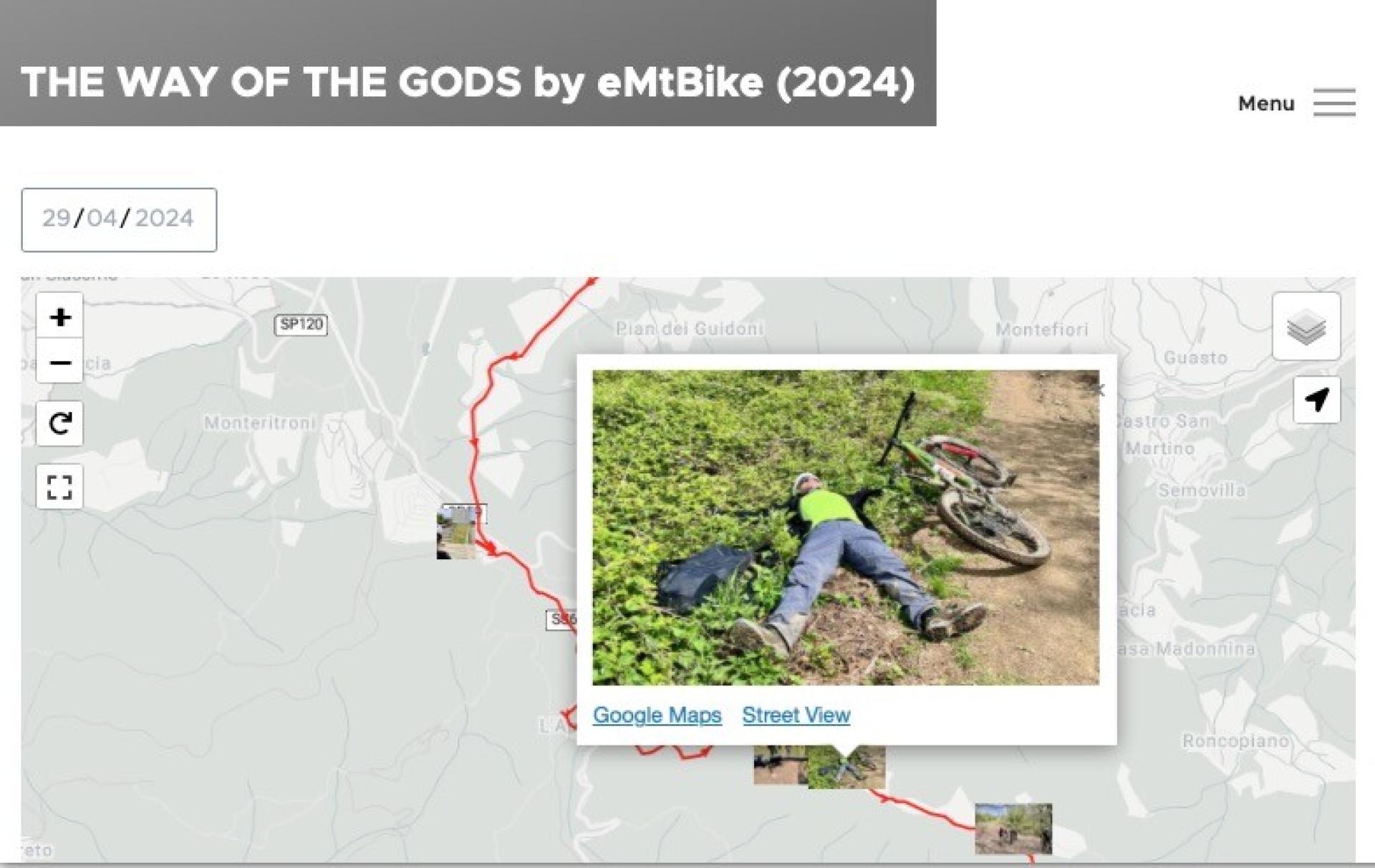
The application features an interactive map and an image gallery that provide users with a geographic context and visuals of the scenic journey. Key functionalities include GPX track integration, EXIF data handling, waypoint generation, and enhanced content entities. This project not only showcases the capabilities of the Geofield Stack in enhancing storytelling through interactive maps but also underscores Drupal's flexibility and the robust community supporting its ongoing development. Further details and insights about this project can be found in Italo’s LinkedIn publication.
Image Attribution Disclaimer: At The Drop Times (TDT), we are committed to properly crediting photographers whose images appear in our content. Many of the images we use come from event organizers, interviewees, or publicly shared galleries under CC BY-SA licenses. However, some images may come from personal collections where metadata is lost, making proper attribution challenging.
Our purpose in using these images is to highlight Drupal, its events, and its contributors—not for commercial gain. If you recognize an image on our platform that is uncredited or incorrectly attributed, we encourage you to reach out to us at #thedroptimes channel on Drupal Slack.
We value the work of visual storytellers and appreciate your help in ensuring fair attribution. Thank you for supporting open-source collaboration!


ASK: Drupal Community Needs Your Support
View all →
Disclosure: This content is produced with the assistance of AI.
Disclaimer: The opinions expressed in this story do not necessarily represent that of TheDropTimes. We regularly share third-party blog posts that feature Drupal in good faith. TDT recommends Reader's discretion while consuming such content, as the veracity/authenticity of the story depends on the blogger and their motives.
Note: The vision of this web portal is to help promote news and stories around the Drupal community and promote and celebrate the people and organizations in the community. We strive to create and distribute our content based on these content policy. If you see any omission/variation on this please reach out to us at #thedroptimes channel on Drupal Slack and we will try to address the issue as best we can.

Related People


You may also like