Drupal GIS Modules: Mapping a Canvas of Web Possibilities


Drupal stands out as a versatile tool for mapping, seamlessly integrating with various libraries, technologies, and third-party GIS services. Whether your mapping needs are straightforward or complex, Drupal offers a range of modules to facilitate the process. While there isn't a one-size-fits-all solution, the typical mapping workflow involves input, storage, processing, and output, all of which Drupal can handle effectively thanks to its GIS module ecosystem.
In this article, we've curated a selection of modules tailored for GIS and mapping projects within Drupal. To provide valuable insights, we sought the expertise of Italo Mairo, a prominent contributor to Drupal's GIS module ecosystem. Italo shared his knowledge through email correspondence, helping us identify essential GIS modules that enhance Drupal's ability to store geocoded content and present it visually. Italo is the creator and maintainer of Geofield Map and the maintainer of Geocoder, Geofield, and Leaflet Modules, further enriching Drupal's GIS capabilities.

Here is a list of modules shortlisted.
1. Geofield
Geofield is an advanced Drupal module that caters to the storage, management, and dynamic representation of geographic data. The module is actively maintained and compatible with the latest versions of Drupal. As the name suggests, it provides a field type and corresponding widgets to store geographical information. It supports input data in Latitude and Longitude, Well-Known Text (WKT), and Bounding Box. It has full support for the Geocoder module, which allows it to pull data from an Address field or Geofield Map. With over 59,000 sites relying on its functionality, Geofield has become a trusted and widely used tool in the Drupal community for handling geographic data effectively.
2. Geofield Map
Geofield Map natively integrates with the Geofield module. This module empowers users to manage Geofields with interactive maps in both the back-end and front-end of their Drupal websites. It integrates with views and comes with a map widget and map formatter.
3. Leaflet
The Leaflet module enables site builders to use the Leaflet JS mapping library within Drupal. LeafletJS is a lightweight, free, open-source JavaScript library enabling highly interactive web mapping experiences. This actively maintained module is used by more than 24K websites worldwide. The Leaflet features can be enhanced with modules like Leaflet GeoJSON, Leaflet More Maps, Leaflet More Markers, and Leaflet Layers
4. Geocoder
The Geocoder module wraps the popular PHP Geocoder library for Drupal. This module simplifies the integration of geospatial functionality within Drupal, allowing for the automatic geocoding of text-based point addresses and WKT geometries into Geofield. Geocoder facilitates reverse geocoding and transforming Geofield points into string or text point addresses.
5. Address
Centarro initially contributed the Address module for Drupal Commerce. It is a generic module for Drupal for storing, validating, and presenting international postal addresses. This module provides essential features, including address field types and form elements, country and zone field types, and a comprehensive collection of address formats for 200 nations. With Address, Geocoder, and Geofield, it is possible to reverse geocode any address and store the geolocation information in the geofield module. This enables any entity with an address to be displayed on a map.
6. Geolocation Field
The Geolocation Field module is an alternative to the Geofield module, an all-in-one module offering a specialized field type for storing geographic coordinates in latitude and longitude pairs (lat,lng). Beyond simple storage, it smoothly integrates with various map providers, facilitating the display of these geographic locations through views, fields, and different map services. It has a substantial user base of over 42,000 sites. The Geolocation Field module empowers Drupal users to manage and visualize geographical data within their web projects efficiently.
7. Google Map Field
The Google Map Field module is a simple module that enables users to add a Google Map to any content. With this module, users can easily drop markers on maps, customize the map's zoom level, and save map-related data alongside nodes or other fieldable entities. 42,706 websites use it. If your use case is simple, and you only want Google Maps, this is worth a try. It would help if you either went for the GeoField ecosystem or GeoLocation Field for complex use cases.
8. Simple Google Maps
The Simple Google Maps module for Drupal offers the simplest integration with Google Maps for Drupal. The users can input a Google recognizable address in a plain text field, and it can be rendered in a Google Map or as a Link to the Google Map.
9. Views GeoJSON
Views GeoJSON is a handy Views plugin designed for Drupal users who need to output geospatial data as GeoJSON, a JSON-based text format commonly used for encoding various geographic data structures. This module seamlessly integrates with Views, allowing users to generate GeoJSON data feeds from their content. This will accept data in latitude/longitude, Geofield, or WKT formats.
10. Search API Location
The Search API Location module provides the capability of the location-based search and displays search results on a map. It also supports bounding box searches and showcasing the distance to the search point. The module is currently minimally maintained. Drupal developers are invited to be part of the development and make it available for future versions of Drupal, considering its importance in the WebGis ecosystem within Drupal.
Conclusion
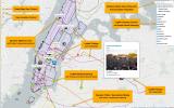
Drupal's ecosystem of Web GIS-related modules empowers site builders to convert it into a powerful platform for storing and visualizing geocoded data. With over 100,000 sites using these modules, Drupal is a compelling choice for your next Web GIS project. A comprehensive demo is available here to highlight Drupal's Web GIS capabilities.
The modules listed in this article and the relevant information are collected from the corresponding project pages at www.drupal.org. We have tried to include the key modules in the Web GIS space on Drupal, which has at least a Drupal 9 release. Please let us know if you know of any other modules worth mentioning here.


Note: The vision of this web portal is to help promote news and stories around the Drupal community and promote and celebrate the people and organizations in the community. We strive to create and distribute our content based on these content policy. If you see any omission/variation on this please let us know in the comments below and we will try to address the issue as best we can.
Related People


Comments
You may also like