



Provider Map Alpha Adds Service-Area Directories to Drupal Without External Map Services

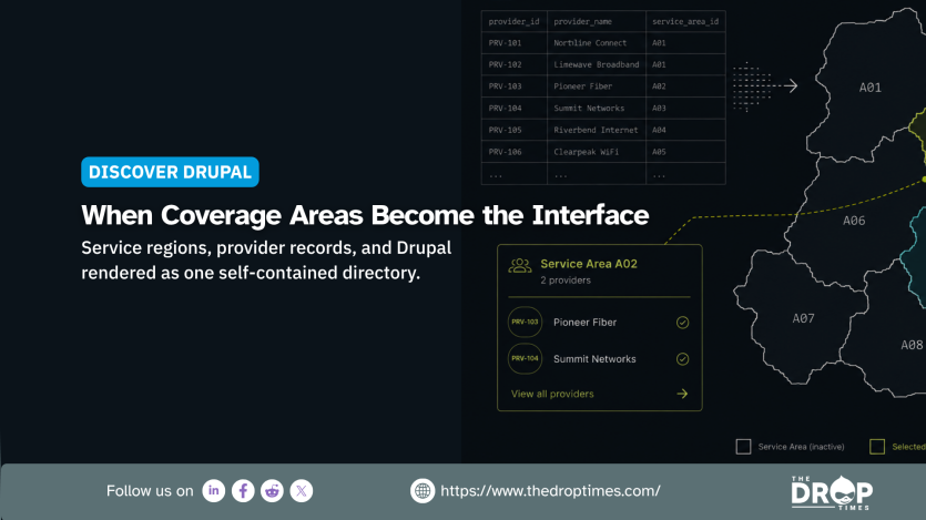
Released on 17 August 2026, Provider Map 1.0.0-alpha1 gives Drupal 10.3 and 11 sites a contributed module for directories organised around geographic service areas. The release notes describe it as the project's first public release and say it requires only Drupal core modules. Provider Map is intended to answer which organisations serve a county, district, or other defined region rather than which provider is geographically closest.
Provider Map stores geometry in Drupal and projects it to inline SVG in the browser, according to the project documentation. Provider records can be imported from CSV files, while service boundaries are supplied as GeoJSON. The map does not require Leaflet, Mapbox, Google Maps, a tile server, or an API key for display, and the project says it makes no third-party mapping request after page load.
That architecture reduces dependence on external mapping infrastructure and keeps the supplied geographic data and map rendering under the site's control. It also means visitor interactions with the map do not need to be sent to an outside mapping provider. Those characteristics may matter to public bodies and other organisations seeking to limit third-party services, although Provider Map does not establish compliance with any particular privacy, procurement, or digital-sovereignty requirement.
The project documents several keyboard and screen-reader-oriented behaviours, but it does not cite an independent accessibility audit. Regions are rendered as focusable, labelled SVG paths, result changes use an aria-live region, and the complete directory is rendered server-side before JavaScript runs. The documentation also describes focus management for the detail dialog, responsive table-to-card presentation, and support for prefers-reduced-motion and prefers-color-scheme.
Site builders can configure maps, regions, providers, and categories, while the CSV importer validates rows before writing data. GeoJSON import supports property mapping and simplification, and maps can expose configurable tooltips, filters, and detail panels. The bundled provider_map_example submodule uses all 102 Illinois counties with a fictional child care directory whose organisations, contact details, and programmes are invented.
Provider Map does not provide a street basemap, geocoding, routing, distance search, or nearest-provider queries. The project directs sites requiring a basemap, street markers, or distance search to Leaflet or Geofield Map. Sites requiring address geocoding would need a separate tool such as the Geocoder module.
The release notes describe the alpha's functionality as complete but say its configuration schema may still change in response to early feedback, with no guaranteed upgrade path until 1.0.0. Provider Map is also not covered by Drupal's security advisory policy. Teams evaluating the module for production use should account for both limitations while the project remains in alpha.


ASK: Drupal Community Needs Your Support
View all →
Disclosure: This content is produced with the assistance of AI.
Note: The vision of this web portal is to help promote news and stories around the Drupal community and promote and celebrate the people and organizations in the community. We strive to create and distribute our content based on these content policy. If you see any omission/variation on this please reach out to us at #thedroptimes channel on Drupal Slack and we will try to address the issue as best we can.

You may also like